
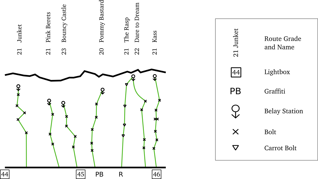
A simple map showing sport climbing routes at the Kangaroo Point Cliffs in Brisbane, Australia. With just the essential information printed on a single sheet of paper, this concise and convenient map is easy to use while actually climbing. Better yet, it's completely free. If you're viewing the map on your phone you can use the image on its own for a better experience.
The map shows one section of the cliffs on either page. For each route the anchors and bolts are marked, with names and grades above. Navigate using the numbered light boxes at the base of the cliffs and keep an eye out for routes labeled with graffiti.
There is also a table of routes which can be used as a tick-list.

The entire map is hand drawn by myself. That said, it owes a lot to the wonderful resources at The Crag and the SE Queensland guidebook. Take a look at those if you'd like more detailed information about the cliffs as well as information on routes I've left off the map.
I made this map for myself and now that the work is done I'm happy to give it away. Print one for you and your friends! However, I would prefer it if you sent people to this page rather than sharing the pdf directly.
If you notice any mistakes, or would like to make a suggestion, feel free to send me a message at tom@jjdat.com.
© Tom Chappell